Toolbox — For Training and Youth Work
All new tools in your inbox: Be the first to know about new tools for learning with our e-mail notifications.
Exercise, Info session
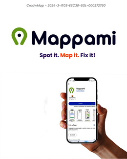
Mappami — Participatory urban mapping for civic engagement
A free mobile app that lets citizens and associations report urban issues (potholes, missing trees, barriers) on a shared public map. Built with communities, for communities. Co-funded by the European Solidarity Corps.
Aims of the tool
To lower the barrier to civic participation by making urban issue reporting fast, intuitive and visible to all.
To bridge the gap between citizens who identify problems and institutions that can address them.
To support local associations in their advocacy work with structured, shareable geographic data.
Description of the tool
Mappami is a free mobile application developed by Active Citizens, a group of five young people from Rome, as part of the CrowdMap project co-funded by the European Solidarity Corps (ESC30).
The app allows citizens and local associations to report urban issues by geolocating and photographing them in real time. Reports are displayed on a shared public map, creating a collectively built dataset that citizens, associations and local authorities can use to prioritise interventions and allocate resources more effectively.
The tool was developed through a participatory design process: workshops were held with local associations and citizens of different ages to co-design features and test usability. People with low digital literacy were included from the start, and the interface was refined based on their feedback.
Associations can create an organisation profile to run thematic mapping campaigns (for example, mapping missing trees, inaccessible pavements or recurring flood points) and export data for advocacy purposes.
The app is publicly available on App Store and Google Play. All reports are visible to anyone. The model is designed to be replicable in other cities and contexts.
Learning outcomes for participants involved in building and using the tool: civic agency, digital skills, participatory design, data literacy, community organising, dialogue with institutions.
Available downloads:
Disclaimer
SALTO cannot be held responsible for the inappropriate use of these training tools. Always adapt training tools to your aims, context, target group and to your own skills! These tools have been used in a variety of formats and situations. Please notify SALTO should you know about the origin of or copyright on this tool.
Tool overview
http://toolbox.salto-youth.net/5586
This tool is for
Citizens of all ages, local associations, NGOs, youth groups, municipalities interested in participatory urban governance and civic tech.
and addresses
European Citizenship, Youth Democracy projects, Youth Participation, Environment
It is recommended for use in:
European Voluntary Service
Meetings between young people and decision-makers
Materials needed:
A smartphone (iOS or Android). The app is free to download and use. No registration required to view the map; simple registration to submit reports.
Duration:
The app itself takes under 5 minutes to learn. For community workshops using Mappami as a hands-on tool: half a day (3–4 hours) recommended, combining a brief intro, practical mapping session outdoors or indoors with mockup, and feedback debrief.
Behind the tool
The tool was created by
Active Citizens — Group of young people, Rome, Italy. Contact: mappami.eu
in the context of
CrowdMap — ESC30 Solidarity Project, co-funded by the European Union. Project code: 2024-3-IT03-ESC30-SOL-000272760. Duration: May 2025 – April 2026.
The tool has been experimented in
Two community workshops in Rome (Municipio XII), one focused on local associations (September 2025) and one open to citizens (March 2026). Participatory mapping sessions during neighbourhood walks. Public launch event (January 2026).
The tool was published to the Toolbox by
Lisa Bortune (on 9 April 2026)
and last modified
2 April 2026
Comments
No comments have been posted yet.
If you want to comment on this tool, you need to be signed in with your MySALTO account. Sign in now